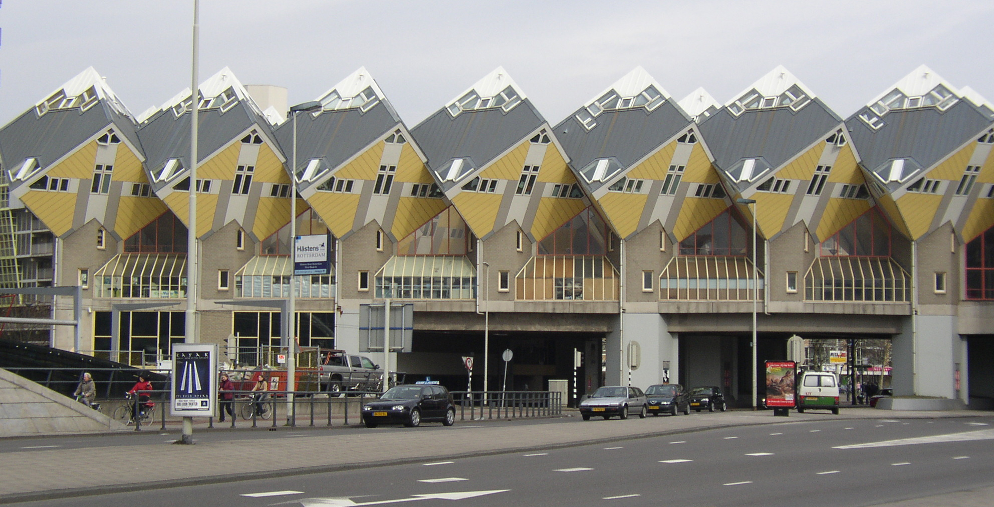
Cube Shaped House & museum, Rotterdam, Holland,
Rotterdam (/ˈrɒtərdæm/ or /ˌrɒtərˈdæm/;[8][9] Dutch: [ˌrɔtərˈdɑm] (
Haneda Airport,Susumu Sasaki,Japan Air Lines,Japan_羽田空港、佐々木進、日本航空、日本

Tokyo International Airport (東京国際空港 Tōkyō Kokusai Kūkō), commonly known as Haneda Airport (羽田空港 Haneda Kūkō) or Tokyo Haneda Airport (IATA: HND, ICAO: RJTT), is one of the two primary airports that serve the Greater Tokyo Area, and is the primary base of Japan's two major domestic airlines, Japan Airlines (Terminal 1) and All Nippon Airways (Terminal 2), as well as Air Do, Skymark Airlines, Solaseed Air, and StarFlyer. It is located in Ōta, Tokyo, 14 kilometres (8.7 mi) south of Tokyo Station[more...]
click here to know more about haneda airport:
http://www.haneda-airport.jp/inter/en/
Skagens Museum, Skagen,Denmark.
Skagens Museum is an art museum in Skagen, Denmark,
...which exhibits an extensive collection of works by members of the colony of Skagen Painters who lived and worked in the area in the late 19th and early 20th centuries. Important artists include Maria and P. S. Krøyer, Anna and Michael Ancher, Laurits Tuxen, Viggo Johansen and Holger Drachmann. The museum also hosts special exhibitions. Its facilities include a café located in the Garden House, an old building which for a while served as home residence and studio of Anna and Michael Ancher.
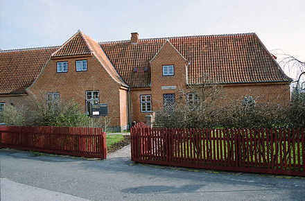
Established 1908.
Location Skagen, Denmark.
Coordinates 57.7246°N 10.5973°E.
Type Art museum.
Visitors 89.004 (2014)[1].
Director Lisette Vind Ebbesen.
Website www.skagensmuseum.dk.
Denmark City and Famous Places of Denmark.डेनमार्क


The Little Mermaid is a bronze statue by Edvard Eriksen, depicting a mermaid. The sculpture is displayed on a rock by the waterside at the Langelinie promenade in Copenhagen, Denmark. It is 1.25 metres tall and weighs 175 kilograms.
Denmark (Danish: Danmark, pronounced [ˈdanmɑɡ] officially the Kingdom of Denmark, is a Nordic country and a sovereign state. The southernmost of the Scandinavian nations, it is south-west of Sweden and south of Norway, and bordered to the south by Germany.
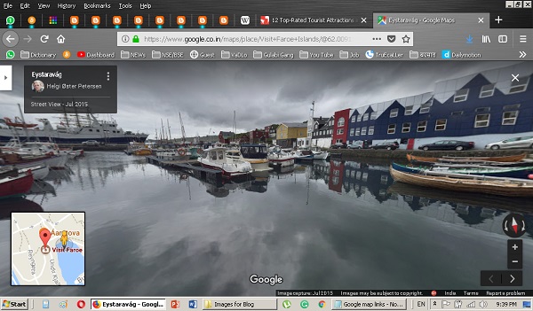
Faroe Islands
The Kingdom of Denmark also comprises two autonomous constituent countries in the North Atlantic Ocean: the Faroe Islands and Greenland.

Cruise Information Center,Copenhagen,Denmark
Denmark proper consists of a peninsula, Jutland, and an archipelago of 443 named islands, with the largest being Zealand, Funen and the North Jutlandic Island. The islands are characterized by flat, arable land and sandy coasts, low elevation and a temperate climate.

The Øresund or Öresund Bridge (Danish: Øresundsbroen, pronounced [ˈøɐsɔnsˌbʁoˀːn̩]; Swedish: Öresundsbron, pronounced [œːrɛ²sɵnːdsˌbruːn]; hybrid name: Øresundsbron) is a combined railway and motorway bridge across the Øresund strait between Sweden and Denmark. The bridge runs nearly 8 kilometres (5 miles) from the Swedish coast to the artificial island Peberholm in the middle of the strait. The crossing is completed by the 4-kilometre (2.5 mi) Drogden Tunnel from Peberholm to the Danish island of Amager. The Øresund Bridge is the longest combined road and rail bridge in Europe and connects two major metropolitan areas: Copenhagen, the Danish capital city, and the Swedish city of Malmö
Denmark has a total area of 42,924 km2 (16,573 sq mi), land area of 42,394 km2 (16,368 sq mi), and the total area including Greenland and the Faroe Islands is 2,210,579 km2 (853,509 sq mi), and a population of 5,781,190 (as of 2018).
 |
Amalienborg (Danish pronunciation: [aˈmæːˀljənbɒːˀ]) is the home of the Danish royal family, and is located in Copenhagen, Denmark. It consists of four identical classical palace façades with rococo interiors around an octagonal courtyard (Danish: Amalienborg Slotsplads); in the centre of the square is a monumental equestrian statue of Amalienborg's founder, King Frederick V.
|
The unified kingdom of Denmark emerged in the 10th century as a proficient seafaring nation in the struggle for control of the Baltic Sea Denmark, Sweden and Norway were ruled together as one realm under the Kalmar Union, established in 1397 and ending with Swedish secession in 1523.

The National Museum of Denmark (Nationalmuseet) in Copenhagen is Denmark’s largest museum of cultural history, comprising the histories of Danish and foreign cultures, alike. The museum's main building is located a short distance from Strøget at the center of Copenhagen. It contains exhibits from around the world, from Greenland to South America. Additionally, the museum sponsors SILA - The Greenland Research Center at the National Museum of Denmark to further archaeological and anthropological research in Greenland.
The museum has a number of national commitments, particularly within the following key areas: archaeology, ethnology, numismatics, ethnography, natural science, conservation, communication, building antiquarian activities in connection with the churches of Denmark, as well as the handling of the Danefæ (the National Treasures).
The areas of Denmark and Norway remained under the same monarch until 1814, often referred to as the Dano-Norwegian Realm, or simply Denmark-Norway. After the Napoleonic Wars, Norway was ceded to Sweden, while Denmark kept the Faroe Islands, Greenland and Iceland. Beginning in the 17th century, there were several devastating wars with the Swedish Empire, ending with large cessions of territory to Sweden.
The National Museum of Denmark (Nationalmuseet) in Copenhagen is Denmark’s largest museum of cultural history, comprising the histories of Danish and foreign cultures, alike. The museum's main building is located a short distance from Strøget at the center of Copenhagen. It contains exhibits from around the world, from Greenland to South America. Additionally, the museum sponsors SILA - The Greenland Research Center at the National Museum of Denmark to further archaeological and anthropological research in Greenland.
The museum has a number of national commitments, particularly within the following key areas: archaeology, ethnology, numismatics, ethnography, natural science, conservation, communication, building antiquarian activities in connection with the churches of Denmark, as well as the handling of the Danefæ (the National Treasures).

Rosenborg Castle Stautes...
Rosenborg Castle Stautes...

In the 19th century there was a surge of nationalist movements, which were defeated in the 1864 Second Schleswig War. Denmark remained neutral during World War I. In April 1940, a German invasion saw brief military skirmishes while the Danish resistance movement was active from 1943 until the German surrender in May 1945.

An industrialized exporter of agricultural produce in the second half of the 19th century, Denmark introduced social and labor-market reforms in the early 20th century that created the basis for the present welfare state model with a highly developed mixed economy...[https://en.wikipedia.org/wiki/Denmark]
 |
The palace is thus home to the three supreme powers: the executive power, the legislative power, and the judicial power.It is the only building in the world that houses all three of a country's branches of government. The name Christiansborg is thus also frequently used as a metonym for the Danish political system, and colloquially it is often referred to as Rigsborgen ('castle of the realm') or simply Borgen |
City Joban LIbrary,Iwaki, Fukushima Prefecture, Japan..福島県いわき市の常磐市陸橋市

Iwaki (いわき市, Iwaki-shi) is a city located in the southern part of the Hamadōri coastal region of Fukushima Prefecture, Japan. .... Jōban coalfield, the largest coalfield in Honshū and the nearest to the Japanese capital Tokyo, ..... Iwaki Lyceum "Alios"; Iwaki cultural center; Iwaki central library; Iwaki museum; Iwaki central park
Iwaki, Fukushima Prefecture,Japan.福島県いわき市。
Iwaki, Fukushima
 |
Onahama Port |
Iwaki (いわき市 Iwaki-shi) is a city located in Fukushima Prefecture, Japan. As of 1 April 2018, Iwaki had a population of 343,258 in 142,265 households, and population density of 280 persons per square kilometre. The total area of the city is 1,232.02 square kilometres (475.69 sq mi), making it the largest city in the prefecture and the 10th largest city in Japan (2010) in terms of area. Iwaki is a designated core city, and is also one of the growing number of cities written in hiragana.
 |
Matsugaoka Park |
The present Iwaki City started as the merger of 14 smaller municipalities on October 1, 1966. Every year Iwaki hosts the Taira Tanabata Festival from 6–8 August.
 |
Outside of Iwaki Railway Station |

Inside Iwaki Raiway Station
Inside Iwaki Raiway Station
Geography and climate
 |
Tokiwa Shrine |
The city is located at the southeastern end of Tōhoku region and borders on Ibaraki Prefecture. The city occupies around 8.9 percent of the total area of Fukushima Prefecture.

Shioyazaki lighthouse
Shioyazaki lighthouse
The eastern part of the city is made up of 60 kilometres of coastline which faces the Pacific Ocean and the western part goes through the Abukuma highlands and joins up with the central part of Fukushima Prefecture.
 |
Iwaki Coal and Fossils Museum |
The western part is a range of mountains and forests, occupies about 70 percent of the city. The rivers which flow to the east from the mountains have riverbeds with steep inclines which form the deep valleys of the Natsuigawa Gorge and the Shidokigawa Gorge. The flatter eastern part of the city is where most of the population is located. There are seven beaches on the coastline.

Iwaki Marine Tower
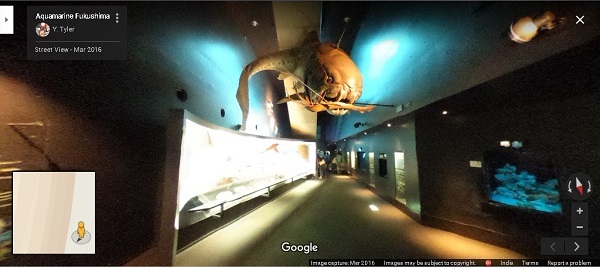
Aquamarin, Fukushima
Off the coast of
Iwaki the warm Kuroshio Current and the cold Oyashio Current meet and make for an abundant fishing ground. The prevailing winds from the ocean are warm and wet.
Iwaki Marine Tower
Aquamarin, Fukushima
 |
Pond_in_the_Matsugaoka_Park,_Iwaki_City |
Every year Iwaki hosts the Taira Tanabata Festival
from 6–8 August.
 |
Taira Tanabata Festival
*****
Thanks for Visit
The End
|
Lázaro Cárdenas, Uruapan, Michoacán, Mexico.
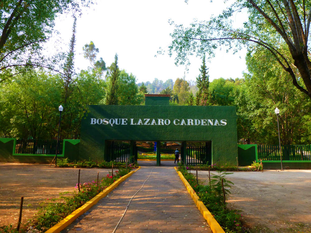
The Lázaro Cárdenas colony is located
in the municipality of Uruapan.

Some of the attractions of the municipality of Uruapan are the Barranca del Cupatitzio National Park, the Tzararacua Waterfall, the Salto Escondido Waterfall, the Caltzontzin Dam, the Cerro de la Cruz, and the Cerro de la Charanda. The "Museum of the House of Culture".
Best Place to visit in India || Chopta-Tungnath || Mini Switzerland

Chopta-Tungnath is the Best place to visit in India. It is the Mini Switzerland of India. June 2017, I started my journey to chopta from New Delhi. Tungnath is the world's highest Shiva temple. In this video you can see many sightseeing places like :- Haridwar Rishikesh ( Yoga Capital of India ) Devprayag ( Ganga's Birthplace - Holy river in Hinduism ) Chopta ( Mini Switzerland 🇨🇭 of India ) Tungnath ( Highest temple in the world ) Chandrashila Peak / Moon Rock ( 14000ft Elevation ) Chopta is situated in Rudraprayag, Uttarakhand, It takes around 5 or 6 hour from Rishikesh to go to Chopta. It is 460km far from New Delhi. You have to do 3km of trek from chopta for tungnath temple And Chandrashila is 1km far from Tungnath Temple at the elevation of 14000ft. In this video you can see Devprayag also.
史跡佐渡金山:Historic site Sado Kanayama, Sado Kinzan, rout 463,Japan.

JAPAN GOLD MINES
Sado gold mine is situated on the route of highway 463 in Japan. It is really a pleasure to roam inside with the mouse. There is a jewellery shop also,try to find it.
佐渡金鉱山は、日本の高速道路463号線にあります。 マウスを使って内部を移動するのは本当に楽しいことです。 ジュエリーショップもありますので、探してみてください。

Discover Palace of Versailles [documentary] (en)

Arches National Park, UTAH, USA.
Arches National Park is a US National Park in eastern Utah. The park is adjacent to the Colorado River, 4 miles (6 km) north of Moab, Utah. It is home to over 2,000 natural sandstone arches, including the world-famous
 Delicate Arch,
in addition to a variety of unique geological resources and formations.
It contains the highest density of natural arches in the world.
Delicate Arch,
in addition to a variety of unique geological resources and formations.
It contains the highest density of natural arches in the world.

Anacapa Island, Channel Islands National Park

Anacapa Island is a small volcanic island located about 11 miles (18 km) off the coast of Port Hueneme, California, in Ventura County. The island is composed of a series of narrow islets 6 mi (10 km) long, oriented generally east-west and 5 mi (8 km) east of Santa Cruz Island. The three main islets, East, Middle and West Anacapa, are collectively known as The Anacapas by some authors. All three islets have precipitous cliffs, dropping off steeply into the sea.
Anacapa is the smallest of the northern islands of the Channel Islands archipelago, and is within the Channel Islands National Park.
सदस्यता लें
संदेश (Atom)